|
Hurricanes - The World's Most Destructive Weather
Observing hurricanes is not just a dry academic exercise - what do you do if they head your way?
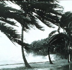
Palm Trees and High Seas
Occurrence and FormationHurricanes are examples of cyclones - a term for any zone of low pressure enclosed within an area of higher pressure, in which the system rotates anticlockwise in the northern hemisphere, and clockwise in the south. Once the sustained wind speed exceeds 74mph (120kph) the system is defined as a hurricane in the Atlantic and eastern Pacific Oceans, a typhoon in the northwestern Pacific, and a tropical cyclone, severe tropical cyclone, or severe cyclonic storm in the southwestern Pacific or Indian Ocean.
An excellent source of information on hurricanes can be found at the National Hurricane Center website. In particular, check out the FAQ section.
Hurricanes occur in most parts of the tropics wherever the ocean waters can heat up to 80°F or 26.5°C but not within about 300 miles (500km) of the equator. They regularly occur in seven areas.
Apart from warm oceans, other requirements for their formation include
Hurricanes usually start as a tropical depression and intensify to become a tropical storm. With further growth, they evolve into a well organised, rotating system with strong sustained winds and heavy rain.
Once wind speed has reached 74mph (120kph), they've earnt the name hurricane.
Hurricane Categories
Because hurricanes vary so much in size and intensity, it has become necessary to categorize them to give some indication of the danger they pose to communities in their path. So while size, internal pressure, and wind speed are all important, other factors such as storm surge are very relevant.
The Saffir-Simpson Hurricane Scale, used in the USA and adjacent areas, is a 1-5 rating based on the hurricane's present intensity. This is used to give an estimate of the potential property damage and flooding expected along the coast from a hurricane landfall. While the hurricane is in open waters, wind speed is the most important factor.
Wind speed is a major contributor towards damage, and also controls the other major cause of destruction, storm surge. However storm surge varies a lot depending on the depth of the sea, the shape of the coast, and the position of the center of the hurricane. As a general rule, storm surge will be greatest to the left of the eye as it nears and crosses the coast, viewing the hurricane from the shoreline. Local disaster coordinators will be able to assess the type of damage likely in their areas.
It is important to keep in mind that hurricane intensities can change quickly. It is always better to be on the safe side, particularly if evacuation is necessary. On the other hand, things may not turn out as bad as they seemed. Both Hurricanes Katrina and Rita from late 2005, devastating as they were, decayed from Category 5 storms to Category 3 by the time they crossed the coast. But while wind speeds were not as severe as they might have been, storm surges generated during their most severe stages remained very high.
Much of the section on the Saffir-Simpson scale has been taken with little alteration from the NOAA page covering classification. I don't like ripping off other sources, but in this case it sppears best to include the full text here.
Category One Hurricane: Winds 74-95 mph (119-153 km/hr). Storm surge generally 4-5 ft (1.2-1.5m above normal. No real damage to building structures. Damage primarily to unanchored mobile homes, shrubbery, and trees. Some damage to poorly constructed signs. Also, some coastal road flooding and minor pier damage. Hurricane Lili of 2002 made landfall on the Louisiana coast as a Category One hurricane. Hurricane Gaston of 2004 was a Category One hurricane that made landfall along the central South Carolina coast.
Category Two Hurricane: Winds 96-110 mph (154-177 km/hr). Storm surge generally 6-8 feet (1.8-2.4m) above normal. Some roofing material, door, and window damage to buildings. Considerable damage to shrubbery and trees with some trees blown down. Considerable damage to mobile homes, poorly constructed signs, and piers. Coastal and low-lying escape routes flood 2-4 hours before arrival of the hurricane center. Small craft in unprotected anchorages break moorings. Hurricane Frances of 2004 made landfall over the southern end of Hutchinson Island, Florida as a Category Two hurricane. Hurricane Isabel of 2003 made landfall near Drum Inlet on the Outer Banks of North Carolina as a Category 2 hurricane.
Category Three Hurricane: Winds 111-130 mph (178-209 km/hr). Storm surge generally 9-12 ft (2.7-3.7m) above normal. Some structural damage to small residences and utility buildings with a minor amount of curtainwall failures. Damage to shrubbery and trees with foliage blown off trees and large trees blown down. Mobile homes and poorly constructed signs are destroyed. Low-lying escape routes are cut by rising water 3-5 hours before arrival of the center of the hurricane. Flooding near the coast destroys smaller structures with larger structures damaged by battering from floating debris. Terrain continuously lower than 5 ft above mean sea level may be flooded inland 8 miles (13 km) or more. Evacuation of low-lying residences with several blocks of the shoreline may be required. Hurricanes Jeanne and Ivan of 2004 were Category Three hurricanes when they made landfall in Florida and in Alabama, respectively.
Category Four Hurricane: Winds 131-155 mph (210-249 km/hr). Storm surge generally 13-18 ft (4-5.5m) above normal. More extensive curtainwall failures with some complete roof structure failures on small residences. Shrubs, trees, and all signs are blown down. Complete destruction of mobile homes. Extensive damage to doors and windows. Low-lying escape routes may be cut by rising water 3-5 hours before arrival of the center of the hurricane. Major damage to lower floors of structures near the shore. Terrain lower than 10 ft above sea level may be flooded requiring massive evacuation of residential areas as far inland as 6 miles (10 km). Hurricane Charley of 2004, a Category Four hurricane, made landfall in Charlotte County, Florida with winds of 150 mph. Hurricane Dennis of 2005 struck the island of Cuba as a Category Four hurricane.
Category Five Hurricane: Winds greater than 155 mph (249 km/hr). Storm surge generally greater than 18 ft (5.5m) above normal. Complete roof failure on many residences and industrial buildings. Some complete building failures with small utility buildings blown over or away. All shrubs, trees, and signs blown down. Complete destruction of mobile homes. Severe and extensive window and door damage. Low-lying escape routes are cut by rising water 3-5 hours before arrival of the center of the hurricane. Major damage to lower floors of all structures located less than 15 ft above sea level and within 500 yards of the shoreline. Massive evacuation of residential areas on low ground within 5-10 miles (8-16 km) of the shoreline may be required. Only 3 Category Five Hurricanes have made landfall in the United States since records began: The Labor Day Hurricane of 1935, Hurricane Camille (1969), and Hurricane Andrew in August, 1992. The 1935 Labor Day Hurricane struck the Florida Keys. Hurricane Camille struck the Mississippi Gulf Coast causing a 25-foot (7.6m) storm surge, which inundated Pass Christian. Hurricane Andrew of 1992 made landfall over southern Miami-Dade County, Florida causing 26.5 billion dollars in losses--the costliest hurricane on record. In addition, Hurricane Gilbert of 1988, plus Hurricanes Katrina, Rita and Wilma were all Category Five hurricanes at peak intensity. Evacuation of residential areas near the shore is likely with Category 3 Hurricanes, and mandatory for Category 4 and 5. But if you are worried, don't wait for the official word.
Other areas affected by hurricanes, typhoons or cyclones use similar intensity scales.
Naming Hurricanes
Hurricanes and their equivalents in other parts of the world
are given names for several reasons. Firstly, a simple
naming system makes the warning process much more effective.
Secondly there may be more than one active hurricane in an area, and individual names allows better reporting of their
positions and threats.
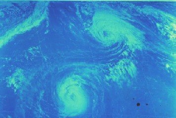
Hurricanes Emmy and Frances interacting in 1976
Names are also given to tropical storms in the North American region, although not elsewhere in the world. This is sensible, as tropical storms can evolve into hurricanes, degenerate back to storms, and even reform to hurricane grade. Regardless of their classification they are a single weather event, and need to be watched until their final decay.
New names are assigned at the beginning of each hurricane season and dealt out in alphabetical order as each storm or hurricane appears. Names may be reused, but names of notable destructive hurricanes (Andrew, Camille, Gilbert, for example) are withdrawn.
The letters Q, U, X, Y, and Z are not used (not very many names start with these letters, giving an annual reserve of 21 names. In most years, thankfully, this is more than enough, but in the record year 2005 it wasn't. Plan B was to use the Greek alphabet, so Alpha, Beta, Gamma, Delta and Epsilon were used late in the season. Even Zeta got the nod for a late storm right at the end of 2005, well after the official end of the hurricane season. OK, take a break before going on to Part 2 - Hurricane Tracking & Recording . Or, for something a bit lighter, try Part 3 - Tracking Hurricane Rita . Nothing too heavy there - just a few notes on what I was able to see using available resources (links are included on the page) as Rita exploded from Category 1 to Category 5 before calming to Category 3 before crossing the Gulf Coast on the Texas - Louisiana border.
More information on Hurricanes can be found among the Severe Weather articles, while you'll find heaps of other great resources -DVDs, videos, books, posters etc - atMore Hurricane Resources Ever wondered what it's like to stay on as a hurricane passes overhead? Check out Hurricane Safety for an account of sitting through Hurricane Wilma as it struck Southern Florida in October 2005. This link will take you back to the Top, or, when you're ready, here's how to return to the Home page. You may be interested to know that you can find out more about weather and home weather stations by receiving our newsletter ,"Watching Weather". It's published more or less weekly, and apart from tips on how to use your weather station and understand what it's telling you about the weather around you, it also covers many other weather related topics. If this sounds interesting, just add your name and email address to the form below. When you join, you'll also receive, totally free, a 20 page guide to setting up and trouble shooting problems in home weather stations. And I promise that you won't get spammed, and that your sign up details will remain totally confidential. Sign up now and receive your first issue almost immediately. Last update 05/24/2011
|


